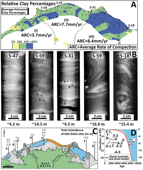
Figure 4.
(A) Map showing distribution of average relative percentages of clay in Holocene sections and average rates of compaction (ARC) in mm/yr across three northern delta sectors (I, II, III); dots indicate sites of 85 sampled drill cores (after Stanley and Clemente, 2014). (B) X-radiographs of selected drill cores sections (locations shown in A): horizontal laminations in S-47; fault-like shears(s) in S-31 and S-59; and convoluted strata units in S-18 and S-59. Scale = 2 cm. (C) Location of seven submerged sites with archaeological material; the 11 numbers indicate depths (in m) of materials below present sea level (after Stanley and Toscano, 2009). (D) Plotted age and depth of submerged materials in C show all lie well below the Eastern Mediterranean sea-level curve of Sivan et al. (2001), recording continued margin subsidence.