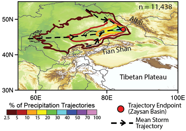
Figure 4.
2-D histogram of storm trajectories between 2005 and 2015 that produced precipitation over the Zaysan Basin, mapped using the Hybrid Single-Particle Lagrangian Integrated Trajectory Model (HYSPLIT) (Stein et al., 2015) (see the GSA Supplemental Data Repository [text footnote 1] for further details). Dashed black lines with arrows—dominant storm trajectories to the Zaysan Basin (red point). Note that all precipitation-producing storms originate to the west of the Zaysan Basin and none traverse the high topography to the south.