Minneapolis Field Trips
417-1
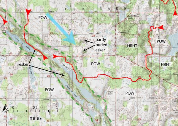
Topographic map of the western part of the Pine Lake (east) and Straight River (west) Segments of the Ice Age National Scenic Trail (red line). We will hike part of the Straight River Segment. Blue arrow shows ice-flow direction. Dashed green line is edge of tunnel channel. Water flowed toward the southeast in the tunnel. HRHT is high-relief hummocky topography and POW is pitted outwash. Map is part of the Big Round Lake USGS Quadrangle, and was created with TOPO!©National Geographic Maps.