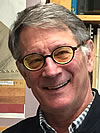
Ray E. Wells
U.S. Geological Survey, Portland
2017 GSA Florence Bascom Geologic Mapping Award
Presented to Ray E. Wells
Citation by Richard J. Blakely
Ray Wells’ seminal contributions to our knowledge of Cascadia tectonics and earthquake hazards, based largely on his own meticulous geologic mapping, epitomize the spirit behind the prestigious Bascom Award for Geologic Mapping. Ray’s geologic maps reach beyond the lines and colors on paper or computer screen; rather they extend to the underlying tectonic and geologic processes reflected in surface geology. His maps are quantitative tools for understanding crustal structure, block rotations, basin evolution, and earthquake hazards. Ray entered the tectonic arena more than three decades ago through study of continental accretion and crustal blocks in the Coast Ranges of Washington. Over many years with the USGS, Ray has combined his own careful geologic mapping with paleomagnetic and other geophysical data to define our modern view of microplates of the Pacific Northwest, illuminate geologic controls on megathrust earthquakes, and provide a conceptual framework for active deformation along the Cascadia subduction margin.
2017 GSA Florence Bascom Geologic Mapping Award — Response by Ray E. Wells
I’m honored to receive the Geologic Mapping Award in honor of Florence Bascom, professor at Bryn Mawr and the first woman hired by the U.S. Geological Survey. My geologic mapping has been a lifelong conversation with the earth, and through it all, my wife Sally has been an enthusiastic supporter and companion. I had excellent tutors: Lauren Wright, Duff Gold, and Barry Voight at Penn State; Brian Baker at the University of Oregon; and Parke Snavely Jr, at the USGS. My colleagues at the USGS have been a constant source of inspiration. The National Cooperative Geologic Mapping and Earthquake Hazards Programs nurtured cooperative ventures with state surveys, and they have been critical to our success. Motivated by Northwest earthquake hazards, our Cascadia convergent margin project experimented early with digital geology and its link to geophysics. Acquisition of lidar and aeromagnetic data, initially through the efforts of Craig Weaver, Rick Blakely, Ralph Haugerud, and Sam Johnson, revealed landscapes and structures beneath the forested Pacific slope. Our mapping, linked to active surface processes and the geophysical data, helped define the structure and motion of forearc crustal blocks. The digital revolution has made geologic maps much more widely accessible and useful. I thank GSA for this award and for recognizing the value of geologic mapping in solving earth science problems.
